Methods and Uses of Topographic Survey
We will talk about topographic surveying in this article.
Introduction
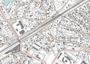
Topographic surveying is the process of figuring out the locations of natural and man-made features in a place, both on the ground and in the air, so that they can be marked on a topographic map with standard symbols. The shape or arrangement of the earth’s surface is what is meant by “topography.”
The main purpose of a topographic map is to show how the terrain of a certain area of land looks in three dimensions. So, a topographic map shows where points are in relation to each other both horizontally and vertically. The difference in height between the two points is shown by the relief.
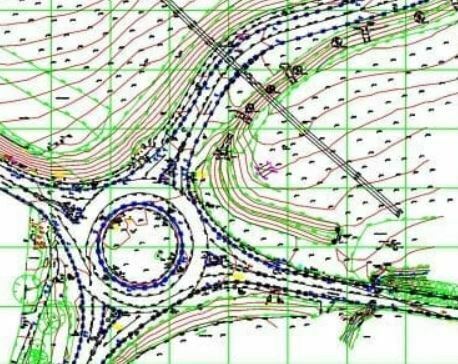
On a plan, shading hachures, form lines, or contour lines can be used to show how high or low each point is. In addition to the relief, the topographic map shows natural features like streams, rivers, lakes, trees, etc., as well as man-made features like highways, railroads, canals, towns, houses, fences, and property lines.
Topographic maps are very important for planning and designing most engineering projects, like where to put railways, highways, irrigation and drainage systems, how to use water power, how to set up industrial plants, and how to plan a city. During a war, topographic maps are also very helpful for planning military operations.

Relief Representation Methods
The way a topographic map shows the relief must accomplish two things.
- The person using the map should be able to see it as a representation of the ground,
- It should also give clear information about the heights of the places shown on the map. On a map, relief can be shown with hachures, form lines, shading, or contour lines.
Hachures are a set of short lines that go in the direction of the slope. When the slope is steep, the lines are thick and close together. When the slope is gentle, the lines are thin and far apart. Even though hachures show the surface shape, they don’t give exact height information. A contour line is a made-up line on the ground that connects points of the same height. It is a line where a level surface cuts through the surface of the ground.
Contours are the most common and accurate way to show the shape of the land on a topographic map. Form lines look like contours, but they are not drawn as accurately. Each form line shows an elevation, but it hasn’t been measured by enough points to meet the usual standard of accuracy for contours. On maps that are used for navigation, form lines are sometimes used to show peaks and hilltops along the coast.
Tinting can also be used to show the relief or heights. The area between two selected contours gets one color, the area between two other selected contours gets another color, and so on.
Topographic Surveying Procedure
Topographic surveying fieldwork is divided into three sections.
- establishing both horizontal and vertical control,
- determining the contours, and
- locating details like rivers, streams, lakes, roads, railways, houses, trees, and so on.
The establishment of the horizontal and vertical control systems is the most important part and the first step in the topographic survey because the three coordinates of a point (i.e. two co-ordinates to locate it horizontally, and one co-ordinate in the vertical plane to locate it horizontally) can only be established or measured with respect to well connected horizontal and vertical control systems.
Horizontal Control
The horizontal control is the backbone of the survey. It is used to find contours and other important details. When the area to be surveyed is small, the horizontal control may be just one station, and each point’s distance and direction can be measured in relation to this station. When the area is pretty big, the horizontal control may be a single traverse or a series of connected traverses.
Depending on how big the area is, the traverses can be done with a tape compass, a plane table, or a tape transit. When the land isn’t even, stadia measurements are sometimes used to figure out the length of the traverse sides.
So, a stadia traverse is used to measure a medium-sized area with a lot of hills. On very large surveys, the horizontal control can be a simple triangulation system or a very complicated one. Traverses, which connect the triangulation stations, provide even more control.
The plane table is sometimes used to run secondary traverses. When triangulation isn’t possible or is too expensive in countries with a lot of flat land and trees, the main horizontal control can be set up with precise traversing.
Vertical Control
Vertical control sets up a framework against which the differences in height can be measured. This control is very important because the relief, or third dimension, must be shown on a topographic map.
The goal of vertical control is to find out how high the primary control stations are or to set up benchmarks near them at regular intervals. High-order spirit-level circuits are used to figure out the heights and define the exact locations of all the control points.
Trigonometric leveling is often used to transfer elevations from precise leveling circuits to triangulation stations. These stations are usually on high, commanding points, and the levels are run as much as possible over the flat or gently sloping ground. Then, the secondary vertical control is set by figuring out the heights of traverse stations or benchmarks close to them. The tachymetric method or the spirit level can be used to figure this out.
When the level is used, the heights of control points can be found by running circuits of levels, or benchmarks can be put in places where they can be seen from nearby horizontal control points. Barometric leveling can be used for rough work.
Locating Details
After the horizontal and vertical control points have been found or set up, the detail is found by measuring the angles and distances to the points that will be on the finished map from the control points.
The measurement of a point (or a set of details) can be used to figure out its three coordinates.
- In the direction from the control point to that point,
- the point’s distance from the control point,
- The point’s height. Angles can be measured with a compass, a transit, or a plane table, which is a set of graphs. You can use a chain or a tape to measure the distance, or you can use tachymetric observations to figure it out.
The point’s height can be found with a hand level, an engineer’s level, or by using stadia, horizontal distances, and vertical angles. First, the control points are drawn on the map, and then the details. The next step is to draw the contour lines, and then the relief is shown with standard signs.
Application of Topographic Surveying
What is uses of topographic surveying?- Putting together topographic maps.
- It is used to make cross-sectional (or topographic) profiles.
- It is also used to set up vertical and horizontal control so that exact locations can be found.
What are the Advantages of Topographical Surveys
The goal of a topographical survey is to help you picture the building or area of land you want to build on. Here are some of the most important reasons why it’s a good idea to talk to topo survey experts:

- Get an accurate and detailed picture of the building and/or land.
- Set up a survey control network that will not only be used for the topo survey but also for the rest of the building process. When sites take a long time to build, updates and additions can only be done in a way that works well and is accurate if you set up a good control network from the beginning.
- Even though the UK’s Ordnance Survey does a good job of “mapping,” it usually doesn’t give enough detail for site development, isn’t always up-to-date, and may not show the boundary features clearly enough for future conveyancing. So, a good, accurate topographical survey will make future boundary disputes less likely or even stop them from happening.
- Learn as much as you can about the land’s shape. Knowing the shape of the land under and around a building is important for design work and for figuring out how much earthwork needs to be done.
Prepare for any risks and take steps to make them less likely to happen. This will eliminate the need for extra costs and delays in the project. - The topographical survey can be used as a “base map” on which multiple parties can share their design work, construction planning, and cadastral/land ownership information, especially if it is shared in a GIS or BIM system.
These are just a few of the most important benefits of making topo surveys. Before sending our geospatial consultants to do the topo survey, we need to think about the following:
- Once we know how much detail we need, we can figure out the best surveying methods and technologies to use.
- Check out the layout of the coordinate system and control network.
Future surveys: How might this topo survey help with work that will be done in the future?
How accurate it needs to be. - Does the project need BIM and laser scanning?
Topographical Surveys by Drone
“Drone surveys” are being asked for by clients more and more. Using UAVs (unmanned airborne vehicles) in our services is just one way we can use technology to do quick and thorough air surveys of topography. But it’s important to remember that the CAA has rules about where we can fly, so the answer isn’t always as simple as people think. Sometimes, we can get to places and take pictures that other methods can’t. Check out our article about drone surveys to learn more about whether you might need UAV topographical surveys for your next project.


